PREVIOUS NIGHT
Forecast relative to the night starting on 2026/07/25
Forecasts in a nutshell
Note: click on a figure to magnify the image. Date of figures refers to the start of night in MST. See color legend.
Seeing *
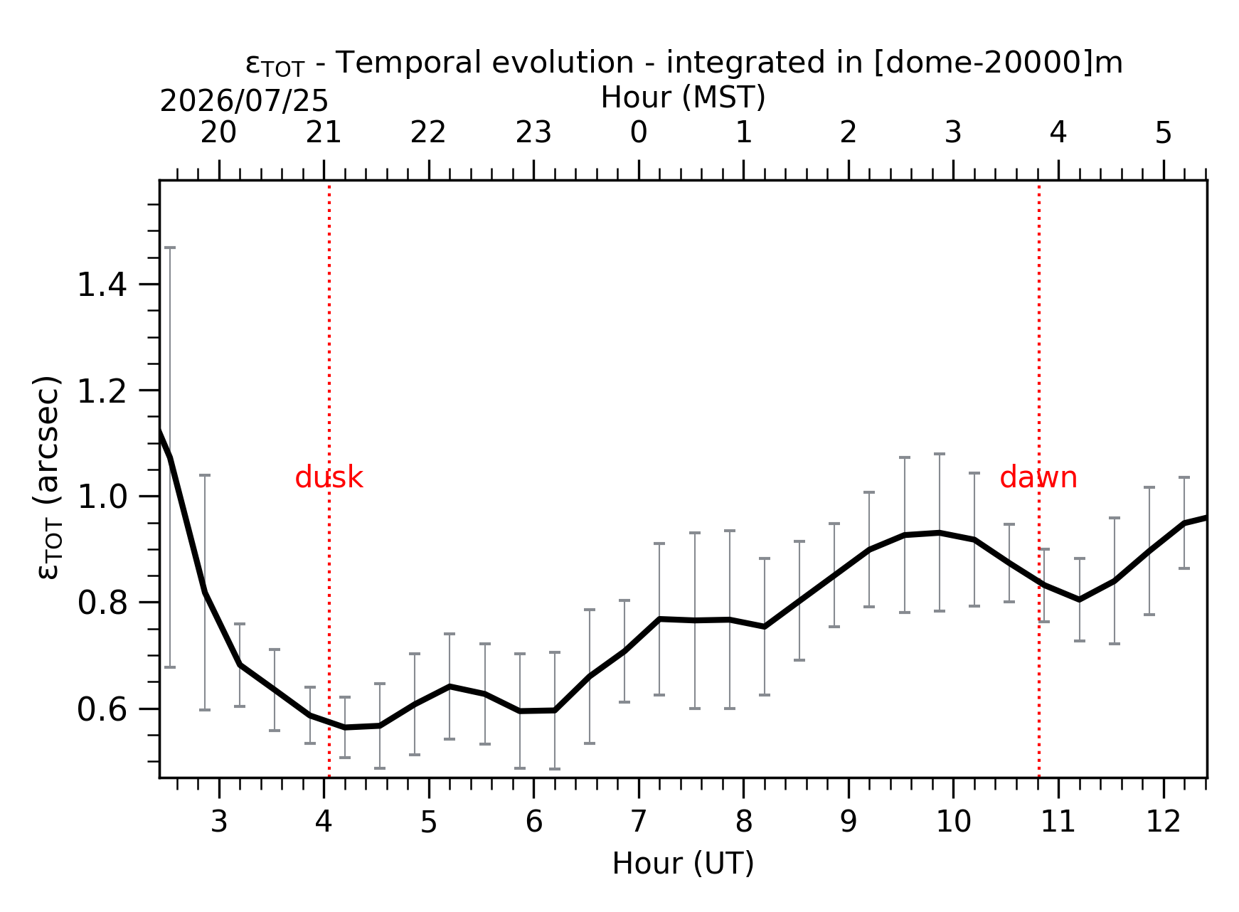
Fig. 1: Temporal evolution of εTOT ([dome-20km]) between the sunset and the sunrise.
Isoplanatic Angle
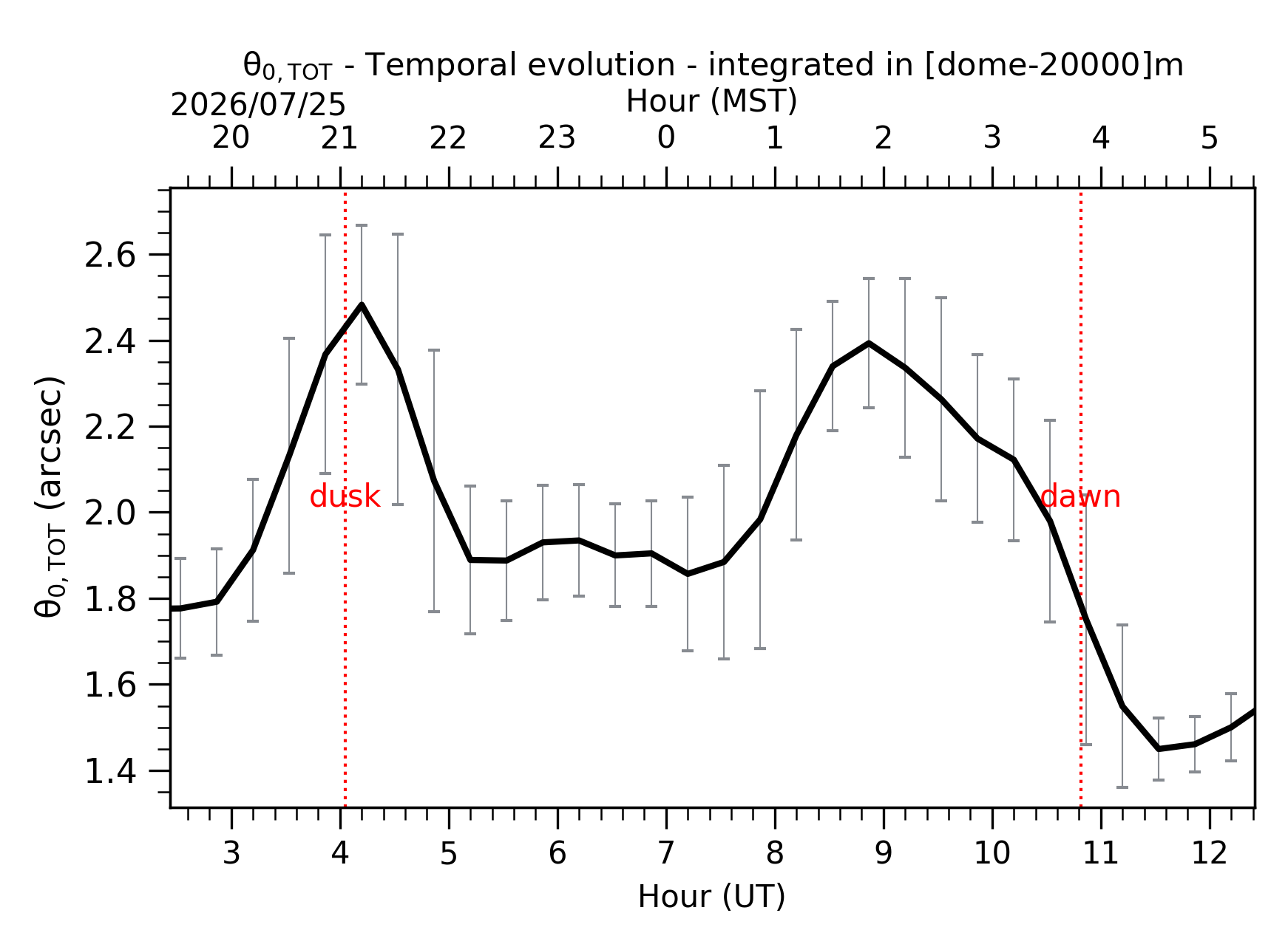
Fig. 2: Temporal evolution of θ0,TOT ([dome-20km]) between the sunset and the sunrise.
Wavefront Coherence Time

Fig. 3: Temporal evolution of τ0,TOT ([dome-20km]) between the sunset and the sunrise.
Temperature at ground *
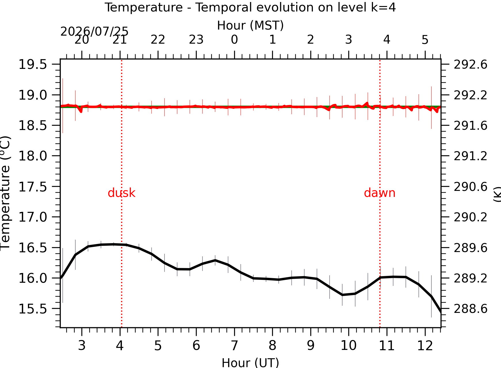
Fig. 4: Absolute temperature temporal evolution between the sunset and the sunrise at [38-62]m.
Wind Speed at ground *
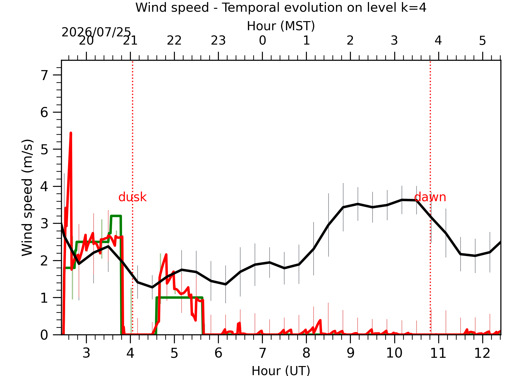
Fig. 5: Wind speed temporal evolution between the sunset and the sunrise at [38-62]m.
Wind Direction at ground *
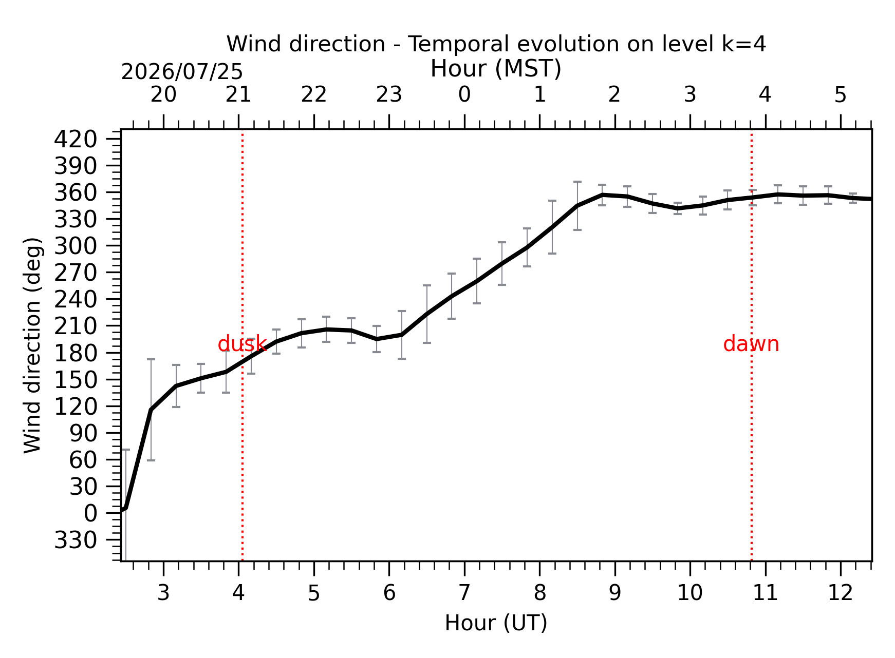
Fig. 6: Wind direction temporal evolution between the sunset and the sunrise at [38-62]m.
Relative Humidity at ground *
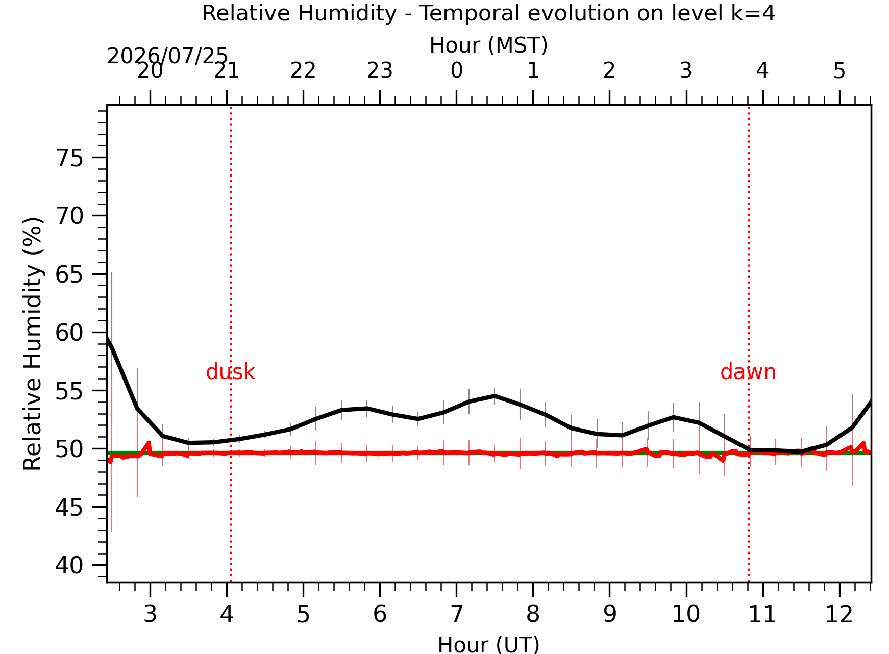
Fig. 7: Relative humidity temporal evolution between the sunset and the sunrise at [38-62]m.
Wind Speed vertical profiles
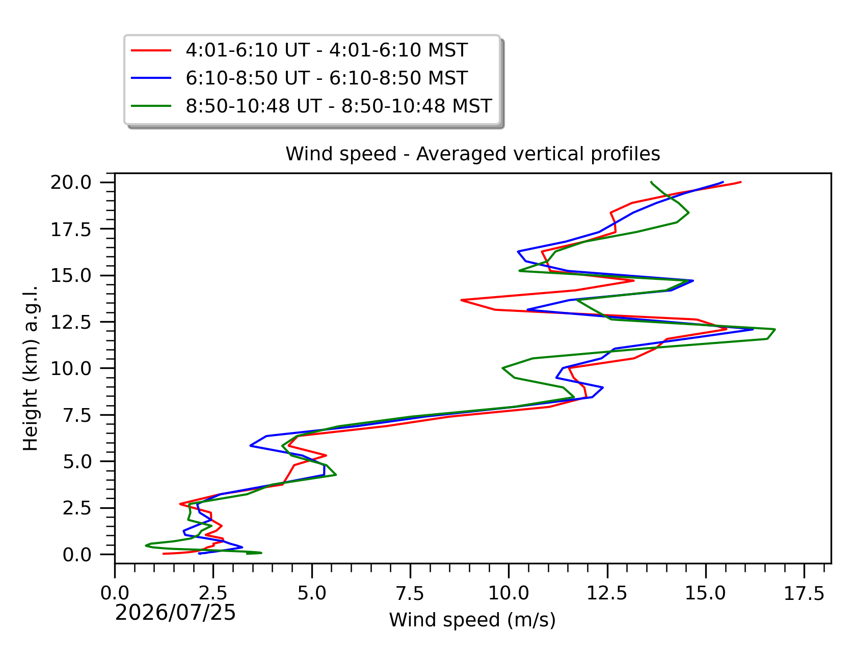
Fig. 8: Averaged wind speed in the three successive periods of the night (see red, blue and green intervals).
Precipitable Water Vapor

Fig. 9: Precipitable water vapor temporal evolution between the sunset and the sunrise.
*: When real time measurements are available (green line) the forecast at short time scale (red or magenta line) is available too, provided it exists at least one more night in the last five nights with observations (condition to apply the AR method). See legend for more details. We remember that the DIMM is located inside the LBT dome. That means that, if the LBT dome is closed for whatever reason including bad weather, we have no real-time seeing measurements and, as a consequence, we have no forecast at short time scale of the seeing.