MR Vertical Profiles
WATER VAPOR
Water Vapor Mixing Ratio
Forecast relative to the night starting on 2026/06/15 MST
Note: click on a figure to magnify the image. Date of figures refers to the start of night in MST.
Vertical profiles of the water vapor mixing ratio are computed in the [0-20km] range above ground level (a.g.l.) and centered on the LBT. Data points frequency is 2 minutes.
TEMPORAL EVOLUTION:
The contour plot represents the temporal evolution of water vapor mixing ratio vertical profiles between the sunset and the sunrise. On the x-axis is time in UT (bottom), in MST (top). Mountain Standard Time MST=UT-7. On the y-axis the height above ground level. The color scale represents the water vapor mixing ratio value.


TIME AVERAGES:
Three time averages are presented, computed in the first, central and last part of the night (see partition). The corresponding MST (MST=UT-7) is shown on the top of the figure.
The blue light halo around each average represents the +/- sigma in the respective time window.
Fig. 5 represents the three time averages in the same plot with different colors to better appreciate the macroscopic changes in the three temporal intervals.

Fig. 3: Average water vapor mixing ratio in the “first part of the night”.
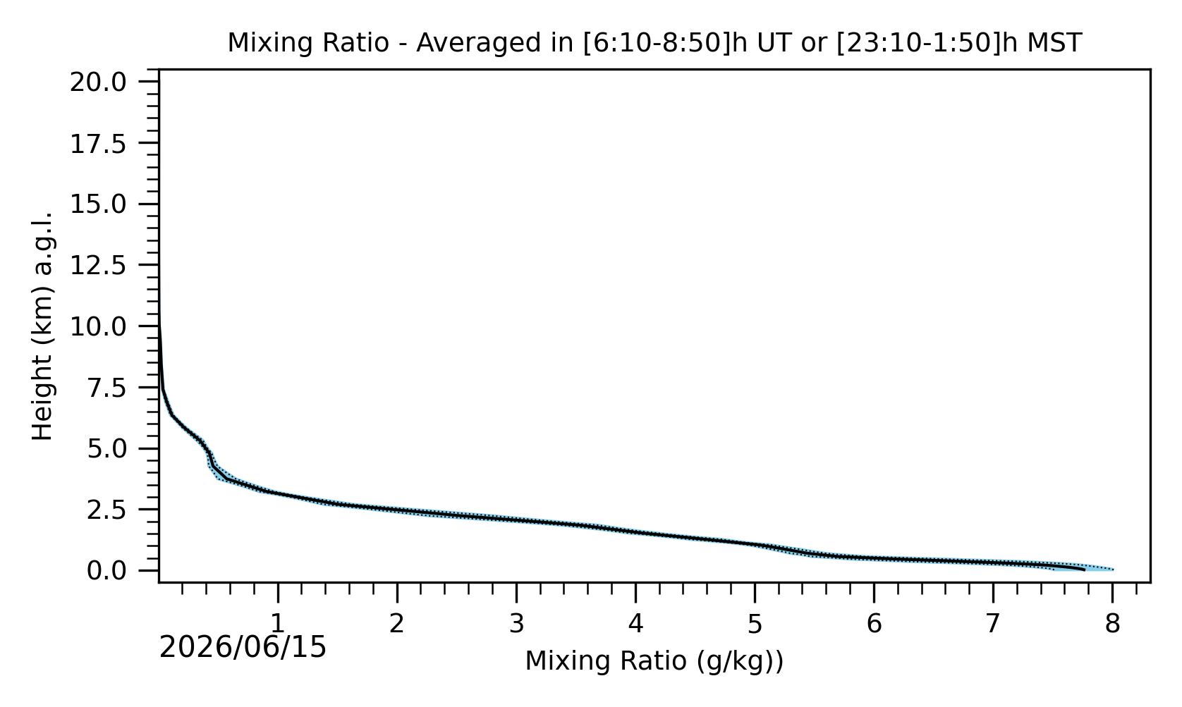
Fig. 4: Average water vapor mixing ratio in the “central part of the night”.

Fig. 5: Average water vapor mixing ratio in the “last part of the night”.
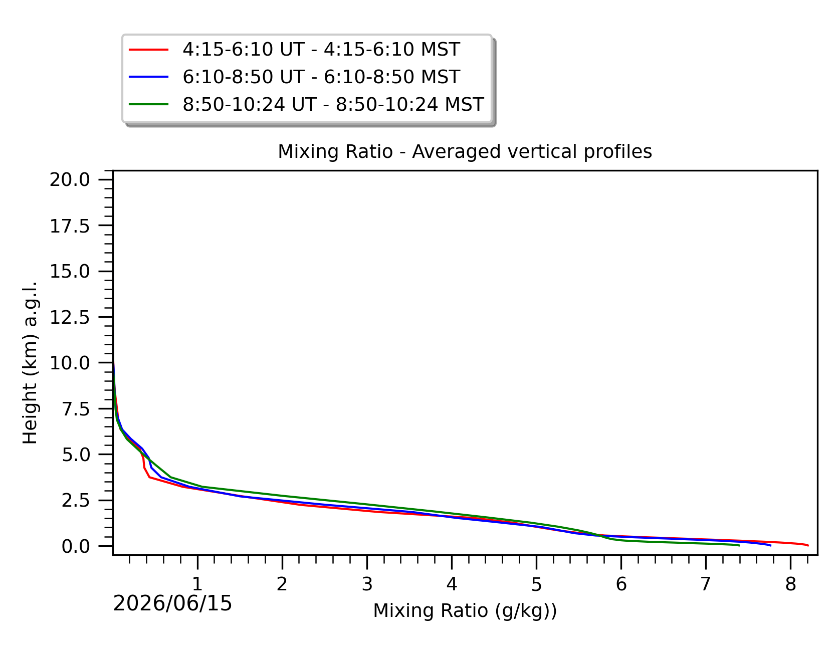
Fig 6: Averaged water vapor mixing ratio in the three successive periods of the night (see red, blue and green intervals).
PWV Temporal Evolution nn
WATER VAPOR
Precipitable Water Vapor
Forecast relative to the night starting on 2026/06/15 MST
Note: click on a figure to magnify the image. Date of figures refers to the start of night in MST.
PWV temporal evolution between the sunset and the sunrise. Astronomical dusk and dawn are shown too. PWV is integrated in the [0-20km] range above ground level (a.g.l.) and centered on the LBT. On the x-axis is time in UT (bottom), in MST (top). Raw data points frequency is two minutes. Data points are re-sampled at a temporal frequency of 20 minutes after a 1-hour moving average. The error bars are the sigma over the 20 minutes sampling, computed before the moving average.

Fig. 1: Precipitable water vapor temporal evolution between the sunset and the sunrise